Tuesday, April 26, 2016

Through the Big Burros In New Mexico

I walked 56-miles in 36-hours. Maybe not a smart thing to do, but I wanted to catch my friends. I got a new pair of Altra Olympus 2.0 shoes, which are a delight to my battered feet. Still, new shoes different set of blisters.
CDT trail sign leading toward the Big Burros

CDT follows old dirt road through the Big Burros


The path out of Lorsdsburg continued through hot, dry desert, and I am glad I did most of it in the cool, early morning hours. The CDT ascended the Big Burros monotonically, occasionally visiting stock water tanks, providing the water I need to survive. I climbed to the high point at Burro Peak, which is just above 8,000-feet, and delighted in the exercise and occasional views through ponderosa pines and juniper.

 Taller brush provides ample, cool shade for breaks during the day through the Big Burros


I descended the Big Burros via the "old route" of the CDT, which followed forest service roads, and eventually a semi-busy highway 90 to Silver City. I rejoined my friends, and am taking a zero day to allow my feet another rest before pushing on to the Gila River. The next two weeks will take me through some remote portions of the CDT in New Mexico, and I am eager to bathe my feet in the cool waters of the Gila!

Looking back to the 8,000-foot peaks of the Big Burros

Saturday, April 23, 2016

85-Miles of Pain

The first stretch of the Continental Divide Trail from Crazy Cook to Lordsburg was... a cooker, literally. With temperatures in the mid-80s and few places to seek shade, I felt like I was in an oven. My feet swelled beyond the capacity of my experimental shoes, and I hobbled into Lordsburg with terrible blisters and foot pain. I am taking a day off to heal up, and am missing the company of my friends, who hiked ahead - I will rejoin them in Silver City.

The Bootheel area of southern New Mexico is an amazing, but harsh landscape. The ocotillo, barrel, and cholla cacti were all in full bloom, and sunrise and sunsets sublime. Enjoying it!

Our crew at the Crazy Cook Monument

Ocotillo bloom at sunset in the Big Hatchet mountains.

Ocotillos in the morning


Cholla cactus welcomes hikers leaving the Big Hatchet Mountains


Hikers walking towards the Coyote Hills


Sunday, April 17, 2016

CDT Kickoff in Silver City


Arrived in Silver City, New Mexico on Thursday night, and got settled into the Carter house. There has been a host of activities throughout the weekend, and I got to sit in on a thru-hiker panel. Yay!

Leaving for the border tomorrow at 6:15 am., and begin my section hike of the New Mexico portion of the CDT.  I am looking forward to stretching my legs!


Billy The Kid's childhood home was located in this spot in Silver City, NM. Ron Howard
donated this replica cabin to sit in its place, which is located right near the visitor center.

Continental Divide Trail Coalition Executive Director, Teresa Martinez, at the CDT Kickoff in Silver City, NM.

Ran into Tony (from TOAKS -Titanium cookware) and Pi, who
hiked the CDT with my housemate So Far in Wyoming in 2010.

These folks led a parade of hikers through the town of Silver City. 

Monday, April 4, 2016

Hiking New Mexico in 2016

I am excited to be hiking on the CDT through the state of New Mexico in April and May of 2016. As with my 2009 hike, I will not be alone, as I set out with Whitney "Allgood" LaRuffa, Brian "Sweet Potato" Mosley,  John "Big John" McCune, and Roger "Greg in Wild" Carpenter. Of course, there will be others starting the same day.

A lot has changed since I hiked the CDT in 2009: My hair is thinning, and turning gray. I now live in Portland, Oregon, and own a general contracting business. I rent a house with friends (So Far CDT 2009), I have a dog, and I own a car. Some things have remained the same: I love long-distance hiking and the community, I remain a bachelor, "American Idol" is still on TV, and Barack Obama is the President.

The Continental Divide Trail is largely the same still winding from Mexico to Canada, through hot deserts to cold, barren, high peaks in the Rocky Mountains. However, the trail has seen a lot of change over the last seven years. The Continental Divide Trail Alliance has dissolved, and from the ashes the Continental Divide Trail Coalition has emerged as the prime advocacy/protector organization for the CDT. Trail angels have come and gone, and the trail itself has been re-routed in several places.
Near the Rio Chama in New Mexico

I will only see the portion through the Land of Enchantment. However, I will experience nearly 180-miles of trail I did not hike in 2009. In southern New Mexico, the trail branches off through the Black Range, winding through Mimbres, Deming, the Florida Mountains, and eventually Columbus/Palomas. That's the route I hiked. This time, I will be starting from the official starting point at Crazy Cook, hiking through the Big Hatchet Mountains up to Lordsburg, then through the Burro Mountains up to Silver City, and then I will hike through the lower Gila River up to Doc Campbell's, where I split off from the official route in 2009. I look forward to this unexplored territory.

I leave Portland in about 10-days, and I am mostly prepared to go. I don't plan on doing to the full digital diary that I did in 2009, but I will make periodic updates to the blog while out there. Those periodic updates will be mostly in the form of pictures with some text. Last time out on the CDT, I found that I spent hours uploading pictures, movies, and typing updates to trailjournals.com. This time around, I plan to enjoy my time in town, and not make many digital commitments.

These next few weeks will be about relaxation, reconnecting with the trail environment, losing a few pounds, getting in shape, and regaining some focus. I look forward to hiking with friends, and making new ones out there. Long-distance hiking is experience life at its fullest, and I intend to do that.

Tuesday, March 8, 2011

A Precarious Hike Up Lava Mountain, Wyoming

I was asked to write an article for the Continental Divide Trail Alliance about some event that happened on the trail.  The article will appear on Backpackinglight.com in the next week or so.  In conjunction with the release of the article, I thought I'd go ahead and upload a video from that day, and here it is:


If there was ever a time where I thought I might die, it was on the CDT on August 14, 2009. I am thankful to be alive.

Tuesday, February 15, 2011

Hiking the Appalachian Trail Confirmed

I have booked my travel to Georgia on March 9th, and I just ordered the AT Guide, written by David "Awol" Miller.   Yep, I am hiking north on the Appalachian Trail for a few weeks!  I still have maps from my 2000 southbound hike that I will bring with me (not that I necessarily need them!) so that I might plot out some possible blue blaze routes.  My goal is to get up to central Virginia, and then head back to California to be the Presentation Coordinator for Annual Day Zero Pacific Crest Trail Kickoff (ADZPCTKO).  More to come later on!
Freefall and Patch (CDT 2009) at Newfound Gap on the
Appalachian Trail in September 2010.

Saturday, January 29, 2011

Memories of the CDT and Hiking on the AT

I was going through some pictures, and I found this shot taken from near the top of Parkview Mountain in northern Colorado.  I miss the CDT.  Tomorrow, I am hoping to meet up with Luna, who just moved up to the Bay Area.  He is looking at hiking the Appalachian Trail starting in June, and he's hoping to do it in just 2 1/2 months!

View of the Divide from Parkview Mountain
I am also looking at a hike on the AT starting in March.  I am thinking about starting in Georgia with the rest of the pack, and walking north to Damascus, Virginia, but I am still open to doing something different.  My interest in the Appalachian Trail has been rekindled following a 70-mile hike back in September 2010, and I am eager to do some hiking before getting serious with an upcoming career opportunity.  Happy Trails!

Thursday, November 18, 2010

One Year Later...

Are you kidding me? I just realized that today is the one year anniversary of my completion of the Continental Divide Trail. I guess I am now a 'has been' in the thru-hiker world of the CDT. Ugh! Nonetheless, I have been reflecting on my life over the last year, and mulling the post-trail dreams that have come to fruition, or have yet to be accomplished. Here are a few of them:

  • My CDT video.  I have 26 hours of footage that I have uploaded to a hard drive, so where's the movie that I am supposed to produce?  Well, ummmm... it's not done... Heck, I have not even stitched on clip together.  I did get some footage from So Far three weeks ago, so I guess that I can say it is in progress.  That said, I need to get my butt in gear, and produce the video.  It will be a long, dark winter up here in Portland, and I will have a lot of evening time to work on it.  Until then everyone has to entertain themselves with my collection of videos here.
  • Trail maintenance.  When I was on the trail, I expressed interest in doing trail work when I finished, since I felt that I needed to give back to the trail, and maintained I did!  During the month of July, I joined up with a Northwest Sevice Academy crew at McArthur-Burney Falls State Park in Northern California, where I helped maintain a 3-mile stretch from Peavine Creek to Red Mountain.  I had a great time, and one can read about my adventure here.
  • Print, mount, and display pictures of the CDT.  Since I have little to no expendable income, I have not done that.  However, I sent my best pictures to the Continental Divide Trail Alliance (CDTA) for their photo contest.  I am keeping my fingers crossed that I win.
  • Renew my commitments with the Continental Divide Trail Society and the CDTA.  I will renew memberships in December.
  • See my friends from my hike.  After the hike, I got to spend time with George and Luna in California, and I saw Luna again at ADZPCTKO.  Also at the Kickoff, I spent some time with Toothfairy, and later saw her up at McArthury-Burney Falls State Park when I was doing trail work.  I also spent time with So Far when he visited California, and now I get to see him weekly as I moved here to Portland.  Panda also lives up here in PDX, and I have yet to visit with him now that I am here.  Finally, I got to see Patch down in Tennessee-North Carolina when I did a 70-mile hike on the Appalachian Trail.  I'd say I have done a good job in this category!
  • Build a hikethecdt.com website.  I just bought the domain last week, and I have started to put the site together.  I look to publish the site in the next week, so be on the lookout for it!
  • Hike.  I'd like to get back on the CDT next year.  Where?  I don't know.  It sure would be fun to do a northbound hike starting in southern New Mexico, as I would love to see that state in blossom in the spring, especially the Gila River Wilderness.  However, I did manage to hike several chunks on the PCT this year... about 150-miles.  I also did a 70-mile Sierras loop hike with my friend Wes, a 20-mile hike at Point Reyes National Seashore with my mom, and a 70-mile hike on the Appalachian Trail.  Not bad for an off year.
  • Get more involved.  I continue my service as the Presentation Coordinator for ADZPCTKO, and since I moved to Portland, I am now involved with the Mt. Hood Chapter of the PCTA as a trail volunteer, and as the chapter secretary.  I am also in the works of applying for a job with a certain trail organization that must remain nameless at this time.  Again, keeping my fingers crossed!
There you have it - my post-CDT trail recap of the year.  Here's to another year of living off the trial... Ugh!  Until next time, enjoy this little video from the bone cave in Montana.

Monday, June 14, 2010

What Do You Think of Warren Lake?

I just did a presentation on the Continental Divide Trail with friends here in San Francisco.  I found this video clip, and I just had to share it here on the blog as a token of the absurd conversations that I had out there with my companions.  Enjoy.


Wednesday, May 5, 2010

Still in Withdrawal

It has been five months since I have finished my hike on the CDT - God I miss the trail. Like some haggard war veteran, I daily experience flashbacks from the trail, but these flashbacks are pleasant. My mundane work is offset by memories of 360-degree views from a high peak in Colorado, supper around a camp with George, Chance, Luna, and So Far in Montana, and beautiful sunsets in Piedre Lumbre section in New Mexico.

It's these visions, however, that are haunting me. So often I wish I could just throw everything in a storage unit and go running off to the mountains for the summer to re-live all those pleasant memories from the trail. Reality is that I cannot. I need to find a vocation that will bring me inner-peace, happiness, and a sense of purpose, and running off to the trail is a bit of escapism. Nonetheless, the trail calls me.

This summer I am going to explore a vocation that has to do with the trail, as I dedicate a few weeks of my life to trail building and maintenance. Today, I got in touch with a volunteer coordinator with the Pacific Crest Trail Association, and we talked about me helping out a trail crew near Burney Falls State Park.

If there is one thing I lack in my trail experience, it is serious trail work, so I think I will go for it. Perhaps through the experience, my relationship with the trail will be transformed to a whole new level. Until that time, I will continue to daydream about windswept vistas, roaring creeks, and living in a tent.

Wednesday, January 13, 2010

Tooth Fairy Makes the News

An article appeared on the web about Tooth Fairy about her hike on the Continental Divide Trail. Check it out. Go Tooth Fairy!

Friday, December 25, 2009

Cool Possible Re-Route in Colorado


Merry Christmas CDT!  I just got word from the Summit Daily News of a 300-acre acquisition of land near the Grays-Torreys peaks area in Summit County.  The land acquisition includes Revenue Mountain, which means that the Continental Divide Trail can now take a true divide route from Grays Peak to Argentine Peak to Santa Fe Peak.  Currently, the trail drops down next to the zinc-polluted Peru Creek, and takes a long, dirt road walk to Montezuma only to have to climb up 2,500-feet to get back up to the Divide again.  Jonathan Ley has included an alternate cross-country route as far as Argentine Pass, and now he can complete his dashed route on the divide until a trail crew gets up there and blazes a more permanent path. 

This past year, I made the hike over Santa Fe Peak, Sullivan Mountain, and Geneva Peak, and the experience was incredible, as the trail hovered over 13,000-feet through this area.  There were spectacular views of the Snake River Valley, Grays and Torreys Peaks, and Mount Evans and Bierstadt.  Hiking the Divide on this new route from Grays Peak down to Glacier Peak will provide yet another incredible high-altitude highlight in Colorado.  Enjoy!

Monday, December 7, 2009

Salida, Colorado Is Top Trail Town for 2009

Salida, Colorado tops the list as the top trail town along the Continental Divide Trail, according 2009 southbounders. Salida, which garnered five first place votes, narrowly edged Steamboat Springs, Colorado (four first place votes) and Pie Town, New Mexico (also five first place votes).

Salida, a town of about 5,600 residents, is located about 30-miles east of Monarch Pass, and it is the new home of The Simple Lodge and Hostel, which is nestled near the center of the artsy town. The hostel opened in early 2009, and it has welcomed hikers with open arms, offering a warm, homely refuge from the cold environs of the rugged Sawatch Range.

One respondent remarked, “The Simple Hostel and its owners were incredibly helpful and concerned with hikers comfort. The town itself had personality, decent gear shops, good food, a theater, a cool place to watch a football game, and all of it was located within a mile. Great town!”

Another said, ““The hostel (Simple Hostel) was great. I love that you could borrow a bike and cruise around. The little shops in town were fun, and Moonlight Pizza was very good.”

Jon Fritz, co-owner of Simple Lodge and Hostel, said, “Most of the folks I know in Salida live vicariously through thru-hikers and love to hear their adventures. People don't have a lot in this town, so they really appreciate people and nature. I give credit to the business owners, who have gone out of their way to create welcoming shops and cafes that serve our tourists and locals alike.”

Hikers remarked that Salida had great beer, a friendly library, fun shops, an awesome place to get a slice of pizza at Moonlight Pizza, and a great place to get a cup of coffee at Café Dawn. The friendliness of the residents in Salida drew high marks, as one hiker noted, “the people had smiles.”

Not to be lost in the shuffle was Steamboat Springs, Colorado and Pie Town, New Mexico, which came in second and third place respectively. Steamboat Springs, a prominent ski resort town in Northern Colorado, provided hikers with wonderful re-supply options with good gear shops, multiple grocery stores, and delightful restaurants. In spite of being spread out, Steamboat Springs provides a free bus service, which “made the town accessible.” Hikers also noted the friendliness of the owners at the Nordic Motel, and the two hot spring resorts (Hot Sulphur Springs and Strawberry Hot Springs).

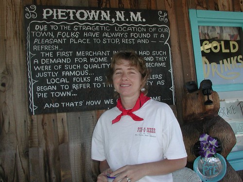
Pie Town, a small town located in west central New Mexico, scored high marks primarily due to the work of Nita Larronde, the owner of the Toaster House, and Kathy Knapp, the owner of the Pie-O-Neer Café. Nita raised her five children in the Toaster House, and now she welcomes hikers into her now former home (she lives in her own place just outside of town). The home comes equipped with a wood-burning stove, stereo system, five beds, a shower, washer, and a large porch for hikers to spread out their gear.

The Pie-O-Neer Café is conveniently located close to the post office in town. Owner, Kathy Knapp, is well aware of hikers passing through, and went out of her way to help hikers with use of her vehicle, and by simply making great pies.

Pie Town is not well known for hiker services, but what it lacked in re-supply options, it made up in great hospitality. One hiker said, “Although Pie Town actually sucked as far as amenities go, the people there were so warm and inviting that you felt like you just arrived home. That made it very hard to leave.” Another said, “So much love! This town was full of love and kindness.”

There was a four way tie for the worst town on the trail. Rawlins, Wyoming, Old Faithful Village in Yellowstone, Macks Inn, Idaho, and Benchmark Ranch in Montana received the worst scores.

Monday, November 23, 2009

Deming Headlight Article

Just before I left Deming, the owner of the Grand Motor Inn told me that there was an article in the Deming Headlight about the sixteen of us finishing our hike at the border.  The article is short, sweet, and to the point.  Panda and Valley Girl did a great job summarizing the experience on the trail, especially in southern Colorado.  My only wish was that all sixteen of us could have been interviewed!

I arrived in Olathe, Kansas yesterday around 7:00 am, and I hung out with my sister and her family most of the day.  Today, I am meeting with Yogi so I can give her a bunch of updates for her CDT Handbook, and I look forward to sharing more of my experiences with her.  Other than that, I still have a lot of typing to do in order to finish my Trail Journal.  If you are keeping up with my trip on Trail Journals, please be patient, as I continue to get all the typing done.  Later!

Thursday, November 19, 2009

Finished!


On Tuesday, November 17th at 2:45 pm, sixteen (let me repeat that) sixteen thru-hikers arrived at the US-Mexican border to complete their odyssey on the Continental Divide Trail. I was honored to be a part of that group, which included Luna, So Far, George, Tooth Fairy, Mike, Patch, Brett, Bree, Panda, Valley Girl, Chance, Brian, Brenda, Samurai Joe, and Hell Fire.

I did it! My dream of hiking the CDT has been realized, and now I join the ranks of those who have hiked the triple crown: The Appalachian, Pacific Crest, and Continental Divide Trails. All that said, I still have a short, but remote and daunting, 30-mile section to complete on the PCT, so my claim to be a triple crowner will not fully be realized until I hike those last few miles. Trust me, I will make it a high priority to finish the PCT.

Arriving at the Mexican border was somewhat of anti-climactic experience. There were a lot of cars entering and leaving the United States at this seemingly busy port of entry. Also, I was warned about tight security at the border, and that the border patrol was not going to put up with any shenanigans, which of course elevated my anxiety level. Finally, there was a freaking Family Dollar right at the border. It's not often that an long distance adventurer finishes his rugged, scenic hike next to a Family Dollar, but I guess that was the choice I made. If I could have chosen differently, I would have preferred a finish at the more remote Crazy Cook Monument near the Hatchet Mountains. I've been thinking that I might do that section in the future. Who knows?


Regardless, I had a great experience through the Florida Mountains between Deming and the border. On my first night out, Tooth Fairy's aunt and her friend, Chris, drove a vehicle out to camp, and delivered brats, hot dogs, smores, salad, etc., which made for the best on trail food that I have ever had. The second day, So Far and I crossed the rugged Florida Mountains on a precarious cross-country route, where I slipped often on loose rock, and was stabbed in the legs by agave and yucca plants. Although a fitting scenic, adventurous trek, I might hesitate to advocate the route through the Floridas, because it was borderline dangerous. Finally, the third day was a short, relaxed hike to the border to complete the hike.

I am hanging out in Deming, for a couple days, and then I will head up to my sister's place for Thanksgiving. I look forward to going to her place for a few days. I have certainly grown tired of trail food and restaurant meals. It all gets old after a while, and I really miss home-cooked food. I told my sister that I cannot wait to get to her place to eat what she makes.

With all the traveling coming up, I plan to work diligently on updating my trail journals site - look for updates. I have uploaded more pictures to Flickr, and I plan to upload a couple video to my YouTube channel tomorrow, so look for that.


I am also thinking about continuing this blog as a part of a larger project to create a site called hikethecdt.com, which will be the primary on-line resource for helping a prospective hiker get started on planning a CDT hike. Expect changes in the future. Until then, I will continue to post items about my post hike journey and all the fall out from taking five months off of work. Happy trails!

Saturday, November 14, 2009

57-Miles to Mexico!

This hike is just about over.  Where did the last 5-months go?  Good heavens!  I am shocked that I only have 57-miles left on this trail.  A part of me wants this journey to end, but a huge part of me wishes that I could continue further.  I love this whole being outside thing, but on the other hand, I really look forward to home-cooked food again.  Oh well, more about that stuff after I finish.

I just finished a segment that went through the Black Range, which included a climb up Hillsboro Peak, which stands about 10,000-feet above sea level.  A fire tower and open cabin sit atop of the peak, and 15 of us hikers camped out at the top.  Unfortunately, So Far did not join the rest of the group on top, as he was too bust thrashing around in the woods doing navigation by deduction.  However, he found his way on the trail again, and hiked ahead of everyone, managing to hike 100-miles in 2 1/2 days!  The guy is a freak.

The hike continued in lower desert areas of southern New Mexico.  In two days I saw two small rattlesnakes on the trail.  The freaky thing was that I did many cross-country miles through desert and dry brush, which seemed to be prime rattlesnake terrain, but nothing ever happened.  I guess the snakes like the flat roads and paths more.

I am currently in Deming, a town of about 20,000-people, which sits about 30 some odd miles north of the Mexico border.  Apparently, when the railroad came through here, the town was called the "New Chicago," as it was expected that this town would boom from the rail traffic.  Ummmmm... that did not happen.  Nonetheless, it is a town that provides a lot of services and cheap motels for the weary hiker. 


Anyway, I will be leaving here tomorrow, and I will be hiking over the Florida Mountains, which according to Jim Wolf, presents a formidable challenge, and a fitting ending for a southbound journey.  I am looking forward to the hike, and with such little time left out here, I will milk the experience for all it's worth.

Today, I attended a Continental Divide Trail Association event in Hachita that celebrated the completion of the southern terminus at Crazy Cook Monument.  It was an awesome event, as I got to meet some of the key players in establishing and protecting the trail here in Mexico.  I had a good conversation with the Executive Director of the CDTA, Steve Dudley, and I was able to share some concerns that we thru-hikers have about the trail.  He was extremely receptive with what I had to share.  Thanks Steve!

I will report about the ending on Tuesday.  Until then, happy trails!

Monday, November 9, 2009

Only 150-Miles To Go!

I arrived in Mimbres, New Mexico last night, and I am taking a well-deserved day off here in town. Ever since Grants, I have been pushing 20 or more miles a day, and that has made me pretty tired and sore, especially on my feet. Despite some of the aches and pains, there have been many rewarding moments.

I just finished hiking through the Gila Wilderness, namely down the Middle Fork of the Gila River, and the scenery was absolutely incredible. Beautiful maroonish-pink rock spires towered over the Gila River, sprouting from the large imposing cliffs that defined the narrow, winding canyon. I could not help but stare up at the rocks overhead, while I hiked through stands of ponderosa pines, cottonwoods, and cedars. Views of the cliffs were abundant as trees and the understory were denuded of their leaves. The Gila River, a shallow river darkened by volcanic rock, slime, and detritus, flowed subtly and calmly through most of the canyon. I forded the cold river over a hundred times! Nonetheless, I felt like I had entered into a lost Eden.

After leaving the Gila River Canyon, I arrived at the Gila Cliff Dwellings National Monument, where I enjoyed a cool, informative tour from a National Parks Service ranger. Although a small cliff dwelling by Mesa Verde standards, this former home to Mogollon Indians between 1270 and 1300 provided a snapshot into the culture and history of the original inhabitants here in New Mexico. I definitely recommend visiting this place.

I have also run into some of the friendliest people out here in New Mexico. Hunters have been generous, sharing their food and water with me and the rest of my companions, which has been a godsend, since water sources are few and far between - I went 39-miles between water sources! Trail angels have also been abundant here, inviting me into their homes, and feeding me home-cooked meals. I cannot say enough about the hospitality of the people here in New Mexico, especially people like John and Anzie north of Pie Town, Kathy and Nita in Pie Town, and Julie here in Mimbres. It's kind folks like them that make this nation truly great.

My shoes are about trashed, which has caused a lot of pain on the pads of my feet. I have had this pain before, and it only comes with shoes which have lost a lot of their cushioning. I figure I have only 8 more days of hiking in them, so I will just man up and deal with the pain.

I continue to hike this trail with 15 other people, and reports from those who keep track of going-ons of the CDT say that a group this size is completely unprecedented. A lot of us hiking in this critical mass wonder if there has ever been another group this large to finish any of the long distance trails like the Appalachian and Pacific Crest Trails. Anyway, it is pretty cool being with everyone, and I enjoy the variety of my company.

I am behind on my trail journals and flickr photos, and I expect it to be that way until I finish. Southern New Mexico, especially where I traveled, has very limited internet access, not to mention technology. I met a woman here in Mimbres who said that she has never seen an iPhone. Crazy! However, sometimes I wonder if that is not such a bad thing.

I will be stopping briefly in Deming, and then I only have another 50-some-odd miles to the border. It should be fun!

Wednesday, October 28, 2009

Grants, New Mexico

I am in Grants, New Mexico, after hiking a solid stretch from Chama to here.  I am with a group of 14 other hikers, and we have decided to stick together for the remainder of the trail.  Who said that this trail was a solitary experience?

New Mexico has been awesome with its long. easy, mesa walks, warm desert terrain, and stunning, colorful scenery.  This has been such a change of pace from the cold, snowy, slopes of Colorado, and a reward of sorts for us southbound hikers.  I also just went over Mount Taylor (11,301-feet), and that peak represents the last time I will be above 10,000-feet on this entire trip.  Yeah!

My next stretch looks to be pretty easy, as I walk to Pie Town.  I understand that there are lava fields in the Malpais National Monument that pose a challenge, but for the most part, it looks like I will remain at 6,000-7,000-feet.

I just updated my trail journals, but I am still behind.  If you are reading my journal, please bear with any mistakes in typing, etc.  Unfortunately, wi-fi internet is shoddy at hotel rooms, so I have to go to places like the Grants Chamber of Commerce - Mining Museum to get things done.  I have also updated my videos, which you will notice on the side the screen here on the blog.  I also uploaded all my current pictures on Flickr.  Check them out.

Again, I am having the time of my life out here on the trail.  I have only 418-miles to go on this journey, and a big part of me does not want it to end.  However, there is that part of me that wants to get this trail finished - that is that part of me that wants to sleep in a warm bed, eat healthy meals, not freeze, and not feel pain in my hips and feet at the end of the day.  In spite of the visual rewards on this hike, it is sometimes taxing on the body and psyche.

I will probably not be able to update things for a while, as I make a long journey from Grants to Mimbres, NM without internet and other digital services.  I hope to make another update in two weeks.  See ya!

Monday, October 19, 2009

Short Break at Ghost Ranch

I walked into Ghost Ranch yesterday around 4:00.  The sun was shining, and temperatures were in the low 70's.  I got a little sun in this last stretch since Cumbres Pass in Colorado, as the weather over the last four days has been spectacular.  I am amazed at how quickly conditions can change over a week.  At this time last week, I was trudging through snow, wind, and cold temperatures.  Yesterday, I walked through red canyons, warm temperatures, and desert terrain.  I was thinking about shedding my warm weather gear in Cuba, but I think that might be a bit too soon.

I will be leaving Ghost Ranch here in about an hour.  I am currently at 6,300-feet above sea level, and from the way it looks, I will be ascending back over 10,000-feet in this short 55-mile stretch - I have some climbing to do!  I look forward to more of the beautiful terrain here in Northern New Mexico, and I can see how the surrounding landscape inspired Georgia O'Keefe with her art.  Pretty cool!

Wednesday, October 14, 2009

Windy South San Juans

I arrived at Cumbres Pass on October 13th, and I am staying with Leprechaun (PCT '03) and his wife Laura.  It is good to be off the CDT, since it was snowing and quite cold when I got off the trail.

The trail from Wolf Creek Pass to Cumbres Pass was, for the most part, tough and brutal.  The first day out of Pagosa Springs was great, although windy.  I slept at Elwood Pass, where two former CDT hikers Puff Puff and Snappy (CDT 2007) had parked their truck, and were providing trail magic.  It was awesome!


On October 11th, I left camp to hike some of the slowest miles I have ever hiked on any trail.  There was so much snow on the the trail, that I could only hike 5.3-miles in four hours.  Winds were also terrible, as they gusted to 40 mph, blowing stinging snow in my eyes and face.  I was hiking through a beautiful area of the South San Juans, with great views of Montezuma and Summit Peaks.  Unfortunately, it was hard to appreciate the views because of the weather.

The group I was hiking with decided to bail on the CDT at Adams Fork in favor of a lower route.  I ascended back to the CDT on October 12th at Blue Lake, and thankfully, the winds had died down, and the snow was melting due to warmer temperatures.  I hiked to Rio De Los Pinos Creek camp, where I met up with Puff Puff and Snappy, who were waiting with hot dogs, chips, and soda pop.  I went to bed that night, and was awakened in the middle of the night by snow, hail, and rain.  Will the weather ever let up?

I spent my last night in Colorado, and when I head back up to the trail on October 15th, I have a mere 4-miles to hike before I leave Colorado, and I say "Good riddance!"  Ever since Tennessee Pass, the weather in Colorado has been horrible.  I am hoping that conditions will be better in New Mexico.  The altitude in New Mexico is lower, which means that there should be less snow.  I am keeping my fingers crossed.